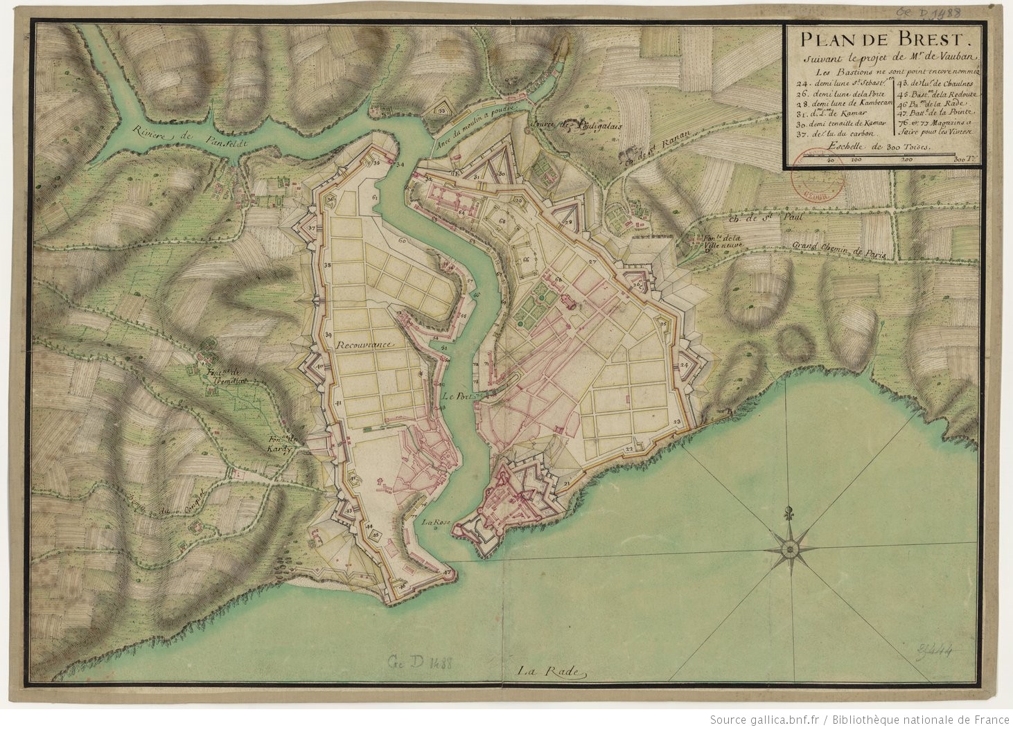
Plan of Brest according to Vauban’s project, late 17th century, Brest Municipal Archives.
Sébastien Le Prestre de Vauban (1633-1707) was probably the most famous designer of fortifications of his time, if not of all time. His fame was on an international scale. Both an engineer and military architect, he gave France the “iron belt” – a defensive system of ramparts that remained functional until the early 19th century and beyond.
He was appointed ‘commander of the place of Brest’ and stayed for some time in the city, whilst remaining critical of its geomorphology which he found unsatisfactory. This plan, drawn up by an anonymous hand, shows the difficulty of adapting Vauban’s ideas to the organisation of the streets, which he would have liked to set out in a more regular pattern. We see this principle applied not only to the left bank of the Penfeld (“Brest-même”), but also to the right bank (Recouvrance). These two areas are united within a protective enclosure which would later pose real problems when the town needed to expand.
Beyond the city walls, the green countryside with its fields and paths, already presages the arrival of the streets that would be laid out on the outskirts of the historic town in the 19th century.
Sonia de Puineuf