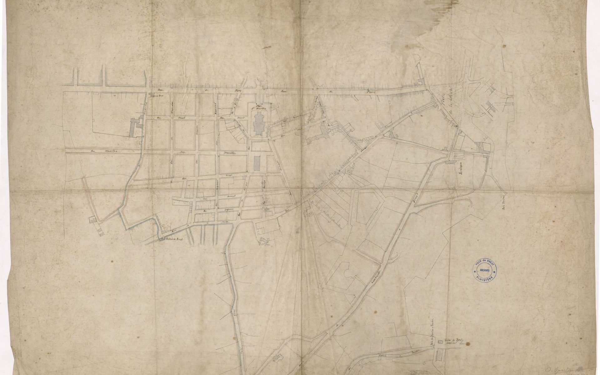
Map of the Saint-Martin district: Annexation plan (1877), from Moulin à poudre road to Valy-Glas, Kerfautras Street, Rue de Paris (Paris Street) and the Place de la Liberté (Freedom square), 1877, Brest Municipal Archives.
The Saint-Martin district (first known as the Annexion district) resulted from the municipality’s desire to create a suburb containing all the necessary living facilities. This urban planning operation came about in response to an increase in population that the city centre could no longer accommodate.
The land acquired by the town of Brest was taken from the neighbouring commune (Lambézellec) – hence the name ‘Annexion’. The land that was once made up of fields with a few farms was transformed into a characteristic ‘end of the 19th century’ style neighbourhood.
This development plan shows the buildings organised in a regular grid of streets branching out from the church dedicated to Saint Martin. The covered market (behind the church), a school and a public washhouse were built here. These buildings embodied the drive for economic and social progress that animated the Third Republic: trade, education and hygiene.
The district suffered little damage during the war and still boasts buildings which date from that period. In addition, more recent development projects have been carried out on land formerly belonging to religious congregations.
Sonia de Puineuf